Loading...
ArmyMOS: 12Y
Geospatial Engineer
The civilian and federal jobs that hire Army Geospatial Engineers — with real salaries and the resume that gets callbacks.
Every 12Y has more options than a Google search will tell you. Below: career paths, BLS salary data, federal GS series, certifications by target career, and how to translate your experience without losing what made you valuable to the Army in the first place.
Free to start · Tailored resume in under 5 minutes
$50K–$132K
Salary Range
BLS-verified median salaries
14
Career Paths
15
Companies Hiring
9
Resume Examples
14
Federal GS Series
8
Certification Paths
10
FAQs Answered
BT
Brad Tachi
Navy Diver · BMR Founder
After the Navy I got hired into 6 federal career fields and tech sales, and sat on federal hiring panels along the way. I spent the last 2 years rebuilding everything I learned into BMR, tuned for how AI actually screens resumes today. This is the system I wish I'd had on day one.
65,000+ resumes built·Success stories every week
Free Sample · Emailed to You
Get a free 12Y Geospatial Engineer sample resume
One page, built in our template, with your military experience translated into civilian terms hiring managers and ATS systems read. Use it as a reference for your own. Drop your email and we'll send you the download link.
Free. We'll also send occasional job-search tips. Unsubscribe anytime.
Military Role Overview
Army 12Y Geospatial Engineers produce the terrain analysis, mapping products, and geospatial intelligence that drives engineer planning and combat operations. The work runs through ESRI ArcGIS Pro, ENVI, GPS surveying gear, and photogrammetry tools to build trafficability overlays, line-of-sight studies, route reconnaissance products, and environmental assessments. 12Ys sit inside engineer brigades, geospatial planning cells, and Topographic Engineer detachments and they typically hold a Secret clearance, with a Top Secret/SCI possible at higher echelon assignments.
Training pipeline: 10 weeks of Basic Combat Training, then roughly 16 to 19 weeks of Advanced Individual Training at the U.S. Army Engineer School at Fort Leonard Wood, Missouri. AIT covers digital terrain analysis, raster and vector data management, GPS data collection, ArcGIS workflows, and tactical decision aids. 12Ys are part of the Engineer Regiment but their day-to-day looks closer to a GIS analyst job than to combat engineering, which is the disconnect that makes the civilian translation tricky.
Civilian employers value 12Ys for three reasons. ESRI ArcGIS Pro proficiency is the dominant skill in commercial and federal GIS work, and 12Ys arrive with thousands of hours in production. The active clearance is a hard requirement at the National Geospatial-Intelligence Agency, USGS programs supporting defense, and most cleared GEOINT contractor roles. And the engineer-side fluency in terrain analysis, environmental assessment, and surveying separates 12Ys from the pool of intel analysts who only know imagery exploitation. If you're trying to pick a starting point, the closest related Army MOS for civilian translation is 35G Geospatial Intelligence Imagery Analyst, and you can compare the broader engineer translation paths via 12B Combat Engineer or browse the full military-to-civilian career crosswalk.
BMR has built more than 55,000 resumes across every MOS, and 12Ys land at NGA, USGS, and federal geospatial programs faster than almost any other Army engineer MOS. The combination of GEOINT-credentialed analysis, ESRI ArcGIS proficiency, and active clearance is exactly what cleared GIS analyst positions need, and you're competing for fewer seats than the standard intel pool. The challenge is reframing engineer-side terrain analysis for civilian GIS hiring managers who don't know the Engineer Regiment exists. — Brad Tachi, Navy Diver veteran & BMR founder
Security ClearanceSecret (TS/SCI possible at higher echelons)
ASVAB RequirementGT: 100, ST: 100
Training10 weeks Basic Combat Training, then 16-19 weeks Advanced Individual Training at the U.S. Army Engineer School, Fort Leonard Wood, Missouri
Certs Earned in ServiceESRI ArcGIS Pro proficiency, Some may earn GEOINT-related qualifications depending on assignment
Pay Reality Check
The number that matters when you're deciding what's next: how does civilian pay compare to what you make now?
Army mid-career
$58K–$82K
E-5 to E-7 total comp (base + BAH + BAS + tax advantage)
Civilian Geospatial Engineer
$50K–$104K
BLS median across direct-match civilian roles
Federal (GS-9 to GS-13)
$58K–$120K
14 matching GS series + locality pay + step increases
+20% on average
Civilian roles for Geospatial Engineers pay ~$14K more than mid-career enlisted total comp.
Military comp is approximate (varies by location/dependents). Civilian is BLS median. Federal includes locality pay. Your real number depends on duty station, family status, GS step, and overtime.
Private Sector Career Paths
The civilian GIS market splits into three distinct lanes for 12Ys: cleared federal GEOINT, commercial GIS, and traditional cartography/surveying. Pay and competition vary sharply across the three, and choosing the wrong lane is the most common mistake we see on the resumes that come through BMR.
Cleared GEOINT and defense contracting
This is the highest-paying and fastest path for 12Ys with active clearances. Geospatial Information Scientists and Technologists (O*NET 19-2099.01) earn a BLS OEWS May 2024 median around $104,000, with cleared GEOINT analyst roles at NGA-supporting contractors frequently posting $90,000 to $140,000+ depending on TS/SCI status and polygraph. The clearance is the gating factor; without it the same job pays $20,000 to $40,000 less. Companies like Leidos, Booz Allen Hamilton, CACI, Peraton, and BAE Systems run the bulk of the contractor footprint. The work overlaps heavily with what 35G analysts and Marine Corps 0241 Imagery Analysts do, but 12Ys bring more terrain and environmental depth.
Commercial GIS and geospatial tech
Esri (the company that makes ArcGIS), Maxar Technologies, Planet Labs, and BlackSky run the commercial side. Roles range from GIS Analyst (a subset of O*NET 19-2099) to Cartographer (17-1021.00, BLS median $76,210) to remote sensing scientist. Pay is lower than cleared work but the clearance isn't a hard requirement, and the technical ceiling is higher because you'll touch satellite tasking, machine learning pipelines, and modern cloud GIS architecture. Esri's Veteran Hiring Initiative is one of the more genuine programs. For salary expectations on the move from military to private sector, the military-to-civilian salary guide walks through how to price your experience.
Traditional cartography, surveying, and engineering services
Surveying Technicians (17-3031.00) sit around a $50,180 BLS median and Photogrammetrists fall under 17-1021.00. AECOM, Jacobs, Stantec, and HDR hire 12Ys into engineering services and infrastructure mapping work supporting transportation, utilities, and environmental compliance. This lane pays less than cleared GEOINT but it's a strong fit if you're done with the defense industry. Environmental Scientists (19-2041.00, BLS median $80,060) is an adjacent path that works for 12Ys with environmental assessment experience. If you came up doing horizontal construction support, the 12N Horizontal Construction Engineer page covers the construction side directly.
Geographic concentration matters. Cleared GEOINT clusters in the DC metro (NGA Springfield, Fort Belvoir), St. Louis (NGA West), Denver (NGA-aligned contractors), and Tampa (CENTCOM/SOCOM). Commercial GIS is more distributed but Esri's Redlands, California campus and Maxar's Westminster, Colorado facility are the largest single concentrations. BMR's military resume builder handles the translation from Army Engineer Regiment language to GIS hiring manager language.
Civilian Job Title Translations
| Civilian Job Title | Industry | BLS Median Salary | Outlook | Match |
|---|---|---|---|---|
Geospatial Information Scientist / Technologist O*NET: 19-2099.01 | Defense & Intelligence | $104,000 | Faster than average | strong |
Cartographer O*NET: 17-1021.00 | Mapping & Surveying | $76,210 | 5% (As fast as average) | strong |
GIS Analyst O*NET: 19-2099.01 | Government & Commercial | $85,000 | Faster than average | strong |
Photogrammetrist O*NET: 17-1021.00 | Mapping & Engineering Services | $76,210 | 5% (As fast as average) | strong |
Surveying Technician O*NET: 17-3031.00 | Engineering & Construction | $50,180 | 4% (As fast as average) | moderate |
Environmental Scientist / Specialist O*NET: 19-2041.00 | Environmental Services | $80,060 | 7% (Faster than average) | moderate |
Remote Sensing Scientist / Technologist O*NET: 19-2099.01 | Defense & Commercial | $104,000 | Faster than average | strong |
Geographic Information Systems (GIS) Manager O*NET: 11-3021.00 | Government & Commercial | $95,000 | Faster than average | moderate |
Geospatial Information Scientist / Technologist
Defense & Intelligence
$104,000median
Faster than average
O*NET: 19-2099.01
Cartographer
Mapping & Surveying
$76,210median
5% (As fast as average)
O*NET: 17-1021.00
GIS Analyst
Government & Commercial
$85,000median
Faster than average
O*NET: 19-2099.01
Photogrammetrist
Mapping & Engineering Services
$76,210median
5% (As fast as average)
O*NET: 17-1021.00
Surveying Technician
Engineering & Construction
$50,180median
4% (As fast as average)
O*NET: 17-3031.00
Environmental Scientist / Specialist
Environmental Services
$80,060median
7% (Faster than average)
O*NET: 19-2041.00
Remote Sensing Scientist / Technologist
Defense & Commercial
$104,000median
Faster than average
O*NET: 19-2099.01
Geographic Information Systems (GIS) Manager
Government & Commercial
$95,000median
Faster than average
O*NET: 11-3021.00
Companies That Hire This Background
Maker of ArcGIS. Hires veterans into technical GIS, software engineering, and customer success roles at Redlands, CA campus and remote.
Satellite imagery and geospatial intelligence company. Headquartered in Westminster, CO. Heavy hiring of veterans for cleared and uncleared geospatial roles.
Operates the largest fleet of Earth-observation satellites. Roles in geospatial analysis, remote sensing, and software engineering.
Real-time geospatial intelligence and satellite imagery provider supporting defense and commercial customers.
Major NGA, NRO, and DoD geospatial contractor. Cleared GEOINT analyst and GIS developer roles across DC metro, St. Louis, and Denver.
Heavy GEOINT and geospatial analytics work supporting NGA, NRO, and combatant commands. Cleared roles at all major locations.
Major geospatial analytics provider. Acquired SOCET GXP and other GEOINT software lines. Cleared analyst and software roles.
Cleared GEOINT, intelligence analysis, and geospatial software development supporting NGA, DIA, and DoD components.
Cleared geospatial and intelligence work across federal civilian and DoD agencies. Strong NGA support footprint.
Major NGA support contractor. GEOINT analysis, GIS development, and geospatial program management roles.
Federal services contractor with GEOINT and geospatial program support. Cleared and uncleared technical roles.
Geospatial analytics and intelligence systems work supporting national security customers. Strong veteran hiring program.
GEOINT systems integrator and major NGA contractor. Cleared technical roles in geospatial analytics and software.
ENVI and IDL software products plus geospatial analytics services. Maker of the ENVI tool 12Ys use in service.
Primary federal employer for cleared geospatial intelligence work. Direct hire authority for cleared veterans. Springfield, VA and St. Louis, MO.
See a salary you want? Build a resume targeting it.
BMR rewrites your 12Y experience for any of the civilian roles above — keywords, achievements, and language hiring managers actually scan for.
Free to start · 2 tailored resumes included
Real Army success story
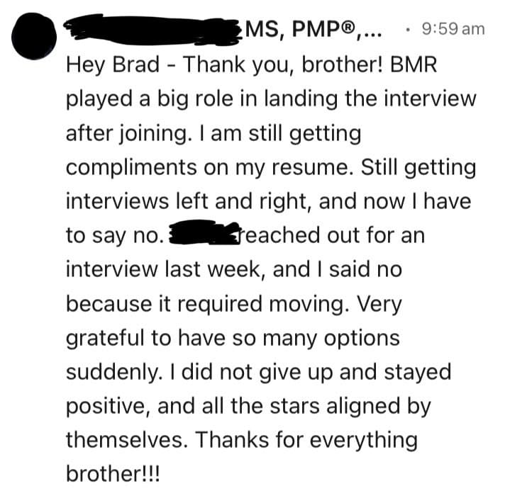
“I am still getting compliments on my resume. Still getting interviews left and right, and now I have to say no. Very grateful to have so many options suddenly.”
Taranjeet· Sergeant (E-5)· Army
→ Program ManagementFederal Career Paths
Federal geospatial work is one of the most veteran-friendly career fields in the entire government. NGA, USGS, FEMA, BLM, EPA, NOAA, NASA, and every DoD service component run geospatial programs that hire from the same talent pool. Veterans' Preference plus an active clearance plus ArcGIS production experience is a combination that few civilian applicants can match.
Direct GIS and geospatial series
The GS-1370 Cartography series is the most direct match for 12Ys. NGA, USGS, and DoD components hire heavily into 1370, typically at GS-9 through GS-12 for transitioning veterans with 4-6 years of experience. The GS-0150 Geography series covers broader geographic analysis work and is common at USGS, BLM, and EPA. Both series accept the 12Y experience set without retraining.
Engineering and physical science series
The GS-0801 General Engineering series is open to 12Ys who can document engineering analysis support, particularly for terrain, environmental, or infrastructure assessments. GS-1301 General Physical Science applies to remote sensing and photogrammetry-heavy backgrounds. Both series sit at GS-11 and GS-12 for journeyman roles. Civil engineering tracks overlap with the work covered on the 12N construction engineer page.
Intelligence and analyst series
The GS-0132 Intelligence series is the federal civilian equivalent for cleared GEOINT work, common at NGA, DIA, and CIA. 12Ys with imagery and terrain analysis depth qualify alongside 35-series transitions. The military intelligence civilian careers guide walks through the federal intelligence community structure and how to position a clearance-backed resume.
Operations research, statistician, and program analyst series
The GS-1515 Operations Research and GS-1530 Statistician series fit 12Ys who did data-heavy modeling work. GS-0343 Management and Program Analyst and GS-0301 Miscellaneous Administration are open paths for 12Ys with strong project leadership documentation, often at GS-11 or GS-12.
Veterans' Preference adds 5 or 10 points to your federal application score, and combined with the right resume format that's enough to land interviews. The federal resume is its own format with hours per week, supervisor contacts, and detailed duty descriptions, and it runs longer than a private-sector resume. BMR's federal resume builder formats the page exactly to OPM standards. When you're ready, you can build your federal resume now.
GS Series & Position Matches
| GS Series | Federal Job Title | Typical Grades | Match | Explore |
|---|---|---|---|---|
| GS-1301 | General Physical Science | GS-9, GS-11, GS-12 | View Details → | |
| GS-0150 | Geography | GS-9, GS-11, GS-12 | View Details → | |
| GS-0132 | Intelligence | GS-9, GS-11, GS-12, GS-13 | View Details → | |
| GS-0460 | Forestry | GS-7, GS-9 | View Details → | |
| GS-0801 | General Engineering | GS-9, GS-11, GS-12 | View Details → | |
| GS-1313 | Geophysics | GS-9, GS-11 | View Details → | |
| GS-1370 | Cartography | GS-7, GS-9, GS-11 | View Details → | |
| GS-1372 | Geodesy | GS-7, GS-9 | View Details → | |
| GS-0455 | Range Technician | GS-9, GS-11 | View Details → | |
| GS-0301 | Miscellaneous Administration and Program | GS-9, GS-11, GS-12 | View Details → | |
| GS-0343 | Management and Program Analyst | GS-11, GS-12, GS-13 | View Details → | |
| GS-0193 | Archeology | GS-7, GS-9 | View Details → | |
| GS-1226 | Design Patent Examiner | GS-7, GS-9 | View Details → | |
| GS-0485 | Wildlife Refuge Management | GS-7, GS-9 | View Details → |
Federal resumes follow different rules. We know them.
Federal hiring uses keyword-matching and structured experience. BMR builds federal-format resumes (USAJobs-ready) with the right keywords, hours/week, and supervisor info — for any GS series above.
Free to start · Federal + civilian resume formats included
Want to Change Careers Entirely?
Not everyone wants to stay in a related field. These career paths leverage your transferable skills — leadership, risk management, logistics, project planning — in completely different industries.
Data Analyst
$83,640
Technology / Business(O*NET: 15-2051.00)BLS OEWS May 202423% (Much faster than average)
data analysisSQL fundamentalsstatistical thinkingdata visualizationExcel/Tableau
12Ys spend their careers querying spatial databases, building data products, and presenting findings to senior leaders. The pivot to general data analytics is shorter than most people realize because the analytical workflow is identical.
How to get there: Tableau Desktop Specialist + SQL fundamentals course (free on YouTube/Coursera) + portfolio project. 3-6 months part-time prep. Apply to data analyst roles, not data scientist roles, for the entry move.
Project Manager
$100,750
Technology / Engineering Services(O*NET: 13-1082.00)BLS OEWS May 20247% (Faster than average)
project planningteam leadershipstakeholder managementbudget trackingrisk assessment
Senior 12Ys with NCO leadership documented strong project management experience through deployments, training cycles, and production schedules. PMP is the credential that makes the switch obvious to hiring managers.
How to get there: PMP certification (3-6 months prep) + civilian-translated resume highlighting project leadership instances. Junior PM or Associate PM roles for the entry, then promote.
Environmental Consultant
$80,060
Environmental Services(O*NET: 19-2041.00)BLS OEWS May 20247% (Faster than average)
environmental assessmentGIS analysissite characterizationfield surveyingregulatory documentation
12Ys with environmental assessment and terrain analysis backgrounds map directly to environmental consulting work, particularly Phase I/II ESA workflows that rely heavily on GIS data products.
How to get there: HAZWOPER 40-Hour + OSHA 30 + portfolio examples of environmental analysis from military work. Junior environmental scientist or field tech role for entry.
Software Developer (GIS / Geospatial)
$132,270
Technology(O*NET: 15-1252.00)BLS OEWS May 202417% (Much faster than average)
Python scriptingArcPy/PyQGISAPI integrationdata modelingtechnical documentation
12Ys who picked up Python scripting and ArcPy in service have a viable path into GIS-adjacent software development. Esri, Maxar, and Planet Labs all hire developers with strong GIS domain knowledge.
How to get there: Python fundamentals course + ArcPy or open-source GIS scripting projects in a GitHub portfolio. Apply for junior GIS developer or geospatial software engineer roles, not generic SWE roles.
Operations Manager
$102,450
Operations(O*NET: 11-1021.00)BLS OEWS May 20246% (As fast as average)
team leadershipworkflow planningresource allocationperformance metricscross-functional coordination
Senior 12Ys with NCOIC experience, deployment cycles, and production cell management have most of the operations management skill set. The harder part is reframing the experience for non-defense employers.
How to get there: PMP or Lean Six Sigma Green Belt + civilian-translated resume highlighting operations leadership. Operations supervisor role for entry, then promote.
Logistics / Supply Chain Analyst
$79,400
Logistics(O*NET: 13-1081.00)BLS OEWS May 202415% (Much faster than average)
data analysissupply trackinginventory systemsgeographic optimizationreporting
12Ys touched supply systems through GCSS-Army equipment accountability and frequently produced geographic logistics products for engineer operations. Supply chain analytics is a viable left-turn pivot.
How to get there: Supply Chain fundamentals course (Coursera/edX) + Tableau or Power BI cert + civilian-translated resume. Junior supply chain analyst role for entry.
Pivoting industries? You don't need to start from scratch.
The skills that made you a good Marine, Sailor, Airman, or Soldier transfer further than you think. BMR rewrites your bullets for any of the pivot careers above — without making you sound like you've never done the work.
Free to start · Try unlimited career angles
Skills Translation Guide
If you're targeting a GIS analyst, cartographer, geospatial intelligence analyst, or remote sensing role, your terminology already lines up. The civilian GIS world uses ArcGIS, ENVI, terrain analysis, photogrammetry, and remote sensing as everyday vocabulary. This section is for 12Ys targeting careers OUTSIDE the GIS and geospatial specialty: data analytics, project management, environmental consulting, software engineering, or operations roles where the hiring manager has never heard of the Engineer Regiment.
Common term swaps
- Geospatial Intelligence (GEOINT) becomes "geographic data analysis combining satellite imagery, mapping, and location intelligence to support decision-making"
- Topographic Engineer Detachment becomes "20-person geospatial analysis team supporting an engineering brigade with mapping and terrain assessment products"
- ESRI ArcGIS Pro stays as ArcGIS Pro (the civilian world uses the same name)
- ENVI stays as ENVI for technical roles, becomes "remote sensing software for satellite imagery analysis" for non-technical hiring managers
- Trafficability analysis becomes "terrain suitability modeling for vehicle routing and infrastructure planning"
- Tactical Decision Aid (TDA) becomes "geographic decision support product"
- Engineer Reconnaissance becomes "field site assessment and data collection for engineering and infrastructure planning"
- BCT/Brigade Combat Team support becomes "supported a 4,000-person organization across multiple geographic regions"
Resume bullet examples (before and after)
Before (military): "Produced TDAs and trafficability overlays in support of brigade-level operations across CENTCOM AOR using ArcGIS Pro and ENVI."
After (data analyst target): "Built geographic decision-support products and terrain suitability models in ArcGIS Pro and ENVI to inform operational planning across a 4,000-person organization, reducing planning cycle time by 30%."
Before (military): "Conducted route reconnaissance and produced engineer running estimates for division G3."
After (project management target): "Led field reconnaissance projects and produced infrastructure analysis reports for senior leadership, supporting capital planning decisions across a multi-state operating area."
For more military-to-civilian translation patterns, see the 50 military terms translated to civilian language guide. BMR's military resume builder handles the translation automatically and you can get started here.
Resume Bullet Examples
Before (Military)
Produced GEOINT products in support of brigade operations across the CENTCOM AOR.
After (Civilian)
Built geographic data analysis products combining satellite imagery, mapping, and location intelligence to inform operational decisions across multi-region deployments.
Before (Military)
Senior analyst in 20-person Topographic Engineer Detachment supporting an Engineer Brigade.
After (Civilian)
Senior analyst in 20-person geospatial analysis team supporting a 4,000-person engineering organization with mapping and terrain assessment products.
Before (Military)
Authored over 150 TDAs supporting brigade-level operational planning.
After (Civilian)
Authored over 150 geographic decision support products informing senior leadership operational planning decisions.
Before (Military)
Conducted trafficability analysis across 5,000 sq km AOR for vehicle routing decisions.
After (Civilian)
Built terrain suitability models across a 5,000 square kilometer operating area to support vehicle routing and infrastructure planning decisions.
Before (Military)
Conducted engineer reconnaissance for forward operating base site selection.
After (Civilian)
Led field site assessments and infrastructure data collection projects to support facility location decisions for new construction.
Before (Military)
Used GCSS-Army to track equipment accountability for survey gear.
After (Civilian)
Managed asset accountability through enterprise resource planning system for technical equipment inventory.
Before (Military)
Senior geospatial analyst supporting a Brigade Combat Team during a 9-month rotation.
After (Civilian)
Senior geospatial analyst supporting a 4,000-person multi-region operating organization during a 9-month assignment.
Before (Military)
NCOIC of geospatial production cell, supervising 6 junior analysts.
After (Civilian)
Team lead of geospatial production unit, directly supervising 6 analysts and managing daily workflow priorities.
Before (Military)
Led AAR following deployment to capture lessons learned for follow-on rotations.
After (Civilian)
Facilitated structured project retrospective after major deployment, documenting process improvements that informed subsequent operational cycles.
Get bullets like these auto-generated for your resume.
BMR turns your 12Y duties and accomplishments into civilian bullets that match the job you're applying for — no manual translation, no rewriting.
Free to start · Tailored to each job posting
Certifications by Career Path
Which certifications you need depends on where you're headed. Find your target career path below.
Cloud Computing
AWS Certified Cloud Practitioner
RecommendedAmazon Web Services
Cost: $100Time: 2-4 weeks prepGI Bill Eligible
Entry cloud cert. Modern GIS platforms run on AWS. Combine with ArcGIS background for hybrid technical roles.
Microsoft Azure Fundamentals (AZ-900)
RecommendedMicrosoft
Cost: $99Time: 2-4 weeks prepGI Bill Eligible
Cloud baseline for Microsoft-aligned environments. ArcGIS Online runs hybrid Azure deployments at many federal customers.
Data Analytics
Tableau Desktop Specialist
RecommendedTableau
Cost: $100Time: 1-2 months prepGI Bill Eligible
Data analytics adjacent to GIS work. Useful for 12Ys pivoting to broader data analyst roles.
Defense Contracting
NCMA CFCM (Certified Federal Contracts Manager)
OptionalNational Contract Management Association
Cost: $425-$525Time: 3-6 months prepGI Bill Eligible
Useful for 12Ys moving into geospatial program management on the contractor side.
Environmental & HAZMAT
OSHA 30-Hour General Industry
OptionalOSHA / OSHA Education Center
Cost: $160-$300Time: 30 hours onlineGI Bill Eligible
Useful for 12Ys pivoting to environmental consulting or field engineering services work.
HAZWOPER 40-Hour
OptionalOSHA-certified providers
Cost: $200-$400Time: 40 hours online plus fieldGI Bill Eligible
Required for environmental site assessment work. Strong fit for 12Ys with environmental assessment background.
Federal Employment
USAJobs Federal Resume Workshop
RecommendedUSAJobs / OPM
Cost: FreeTime: 2-4 hours
Free official training on writing federal resumes that pass OPM minimum qualification screens. Critical for federal applications.
GIS & Geospatial
GISP (Certified GIS Professional)
RecommendedGIS Certification Institute (GISCI)
Cost: $100-$250Time: 4-6 years experience required
Industry-standard credential for civilian GIS work. Portfolio-based, requires documented experience and education points.
ESRI Technical Certification (ArcGIS Pro)
RecommendedEsri
Cost: $225 per examTime: 2-3 months prepGI Bill Eligible
Vendor-specific certification on the dominant GIS platform. Multiple tracks available (Desktop Associate, Professional, Developer).
Intelligence & Analysis
USGIF Certified GEOINT Professional (CGP)
RecommendedUSGIF
Cost: $300-$500Time: 3-6 months prepGI Bill Eligible
Standard GEOINT credential inside the intelligence community. Most relevant for cleared NGA/contractor work.
CompTIA Security+
Required for many cleared rolesCompTIA
Cost: $370Time: 1-3 months prepGI Bill Eligible
DoD 8570 baseline for IAT Level II positions. Required at most cleared contractor billets touching DoD networks.
Project Management
PMP (Project Management Professional)
RecommendedPMI
Cost: $405-$555Time: 3-6 months prepGI Bill Eligible
Standard PM credential. Useful for 12Ys promoting into geospatial program management or pivoting out of technical track.
CAPM (Certified Associate in Project Management)
OptionalPMI
Cost: $225-$300Time: 1-2 months prepGI Bill Eligible
PMP entry-level alternative for 12Ys without 4,500 hours of PM experience documented.
Got a cert? Don't bury it. List it the right way.
The wrong placement can sink an otherwise strong application. BMR knows where each cert ranks, what to call it, and how to frame it for ATS keyword matching and hiring manager attention.
Free to start · Built around your real certs and clearance
Transition Resources
Staying in geospatial and GIS
- USGIF (United States Geospatial Intelligence Foundation) — runs the GEOINT Symposium, publishes the GEOINT credential program, and is the most important professional body for federal and contractor GEOINT work.
- URISA (Urban and Regional Information Systems Association) — civilian GIS professional association, hosts GIS-Pro conference and runs the GISP certification track.
- Esri User Conference — the largest annual gathering of GIS professionals, held in San Diego. Esri runs a Veteran Hiring Initiative and recruits aggressively at this event.
- SkillBridge partners in geospatial — Leidos, Booz Allen, CACI, BAE Systems, and Esri all run SkillBridge-eligible internships. Start the application 6 months before terminal leave. The SkillBridge resume guide covers what employers actually look for.
- NGA Pathways and direct hire authority — NGA hires veterans through both standard USAJobs postings and Pathways. Top Secret/SCI clearance accelerates the timeline significantly.
Careers outside geospatial
- PMP (Project Management Professional) — opens project management roles outside the technical track. GI Bill eligible at most testing centers.
- OSHA 30, CSP, or HAZWOPER — for 12Ys pivoting to environmental consulting, safety, or compliance roles.
- AWS or Azure cloud certifications — modern GIS runs on cloud infrastructure. Cloud cert plus ArcGIS background is a strong combination for technical roles outside the federal sector.
- American Corporate Partners (ACP) — free 12-month mentorship pairing with an executive in your target career field. One of the better networking resources for veterans transitioning.
- SFL-TAP — start the Soldier for Life Transition Assistance Program early. The 6-month-out window is when you should be applying, not exploring.
Defense contractor pathway
If you're staying cleared and going contractor, the defense contractor jobs guide covers how to leverage clearance status during the job search. The big-five contractor channels (Lockheed, Northrop, BAE, Leidos, Booz Allen) all maintain veteran hiring programs but the application paths run through normal channels with veteran flags applied.
See also (related Army and joint MOS pages)
- 35G Geospatial Intelligence Imagery Analyst — closest sibling MOS for civilian translation
- 35F Intelligence Analyst — broader cleared analyst path
- 35N Signals Intelligence Analyst — adjacent intelligence community path
- Air Force 1N1X1 Geospatial Intelligence — joint counterpart on the Air Force side
- Navy AG Aerographer's Mate — meteorology/oceanography overlap for 12Ys with environmental focus
When you're ready, build your resume now.
Your 30 / 60 / 90-Day Transition Plan
Most people do this backwards. They wait until terminal leave to start, then panic. Here's the sequence that works. Already out? Same plan, start at day one today.
1Days 0–30
Set the foundation
- Pull your DD-214 (request from Milconnect if separated)
- List your top 3 civilian roles AND top 3 GS series
- Build your tailored 12Y resume — BMR does it free
- Write 1 strong LinkedIn headline (not "veteran seeking opportunities")
- Pull together your evals/performance reports for accomplishments
2Days 30–60
Apply with intent
- Apply to 5–10 jobs/week — quality over quantity
- Tailor every resume to the job description (BMR auto-tailors)
- Connect with 5 people/week on LinkedIn (not a spray)
- Set up a USAJobs profile and a saved-search alert for your GS series
- Practice translating your military bullets out loud — explain to a civilian friend
3Days 60–90
Close the offer
- Track every application — date, status, contact, notes
- Follow up 7–10 days after each application
- Prep for behavioral interviews using the STAR method
- Negotiate salary — don't take the first offer (BLS median is your floor)
- Stay applying even after one offer — leverage = options
Print this. Tape it to your monitor. Veterans who treat the job search like a 90-day op get hired faster than the ones who treat it like an emergency.
Frequently Asked Questions
What's the average civilian salary for an Army 12Y?
It depends entirely on the lane. Geospatial Information Scientists and Technologists (O*NET 19-2099.01) sit at a BLS OEWS May 2024 median around $104,000. Cartographers (17-1021.00) median around $76,210. Surveying Technicians (17-3031.00) median around $50,180. Cleared GEOINT roles at NGA-supporting contractors frequently post above the BLS median because of the clearance premium.
How valuable is my Secret or TS/SCI clearance for civilian GIS work?
Extremely valuable. An active clearance plus ArcGIS production experience is the exact combination NGA, NRO, and cleared contractors need, and the candidate pool is small. Cleared GEOINT roles often pay $20,000 to $40,000 more than uncleared equivalents. The clearance is also the gating requirement at most defense contractor GEOINT positions.
What if I want to leave the GIS field entirely?
Your data analysis skills, project management experience, and technical aptitude transfer well to data analytics, project management, environmental consulting, and operations roles. The Career Change Paths section on this page lists six BLS-verified pivot options. The <a href='/blog/career-transition/50-military-terms-civilian-equivalents-glossary' class='text-blue-600 dark:text-blue-400 font-medium no-underline hover:underline'>military terms translation guide</a> helps with reframing.
Which federal GS series should I target?
The most direct matches are GS-1370 Cartography and GS-0150 Geography, both common at NGA, USGS, BLM, and EPA. GS-0132 Intelligence is the cleared analyst path. GS-0801 General Engineering and GS-1301 General Physical Science fit engineering and remote sensing backgrounds. Most transitioning 12Ys with 4-6 years of experience qualify at GS-9 through GS-11.
How do I use Veterans' Preference for federal GIS jobs?
Veterans' Preference adds 5 points (TP, time-in-service) or 10 points (CP/CPS, service-connected disability) to your federal application score. Document it in the eligibility section of USAJobs and upload your DD-214 Member 4 copy after separation. NGA, USGS, and most other federal geospatial employers honor preference fully.
Can I use my GI Bill for GIS certifications?
GI Bill funding covers degree programs and many approved certification programs. PMP, GISP, AWS, and ESRI Technical Certifications all have approved testing pathways at various points. Check the WEAMS database (gibill.va.gov) for current approval status before paying out of pocket.
Where are the best geographic markets for 12Y transitions?
Cleared GEOINT clusters in DC metro (NGA Springfield, Fort Belvoir), St. Louis (NGA West Campus), Denver (cleared contractor footprint), and Tampa (CENTCOM/SOCOM). Commercial GIS centers on Esri's Redlands, California campus and Maxar's Westminster, Colorado facility. Cartography and surveying jobs are distributed nationally with stronger demand in growth states.
What's the biggest mistake 12Ys make on their civilian resume?
Listing 'Geospatial Engineer' as the job title without translating what it means. Civilian GIS hiring managers don't know the Engineer Regiment exists. Lead with 'Geospatial Analyst' or 'GIS Analyst' as the translated title and describe the work in ArcGIS production terms, not in Army doctrine terms. <a href='/' class='text-blue-600 dark:text-blue-400 font-medium no-underline hover:underline'>BMR's resume builder</a> handles this translation automatically.
Do I need a degree to work in federal GIS?
For most GS-1370 Cartography and GS-0150 Geography positions, OPM allows substitution of specialized experience for degree requirements. Four years of 12Y experience plus the right resume often qualifies you at GS-9 or GS-11 without a bachelor's degree. For technical lead roles at GS-12 and above, a degree or strong specialized experience documentation matters more.
Should I get a GISP, USGIF GEOINT credential, or both?
If you're going federal or cleared contractor GEOINT, the USGIF GEOINT Professional Certification is more recognized inside the intelligence community. If you're going commercial GIS or state and local government, GISP is the dominant credential. They serve different markets, so pick based on your target lane rather than getting both upfront.
Salary data from U.S. Bureau of Labor Statistics, Occupational Employment and Wage Statistics (OEWS), May 2024. Career data from O*NET OnLine.
Free for every veteran
Translate your 12Y Geospatial Engineer experience into a resume that gets callbacks
Stop rewriting from scratch every time you apply. BMR turns your military experience into civilian and federal resumes — tailored to each job.
What you get — all free:
2
Tailored resumes
AI-rewritten for each job posting
2
Cover letters
Matched to the role
∞
LinkedIn optimization
Profile rewrite for civilian recruiters
∞
Elevator pitch generator
For interviews and networking
2
Company research reports
Know who you're applying to
∞
Job tracker
Manage every application in one place
Start My Free Resume
Free to start · 90 seconds to sign upBuilt by a Navy Diver veteran. More than 65,000 resumes built for the military community.