Loading...
MarinesMOS: 0241
Imagery Analysis Specialist
The civilian and federal jobs that hire Marines Imagery Analysis Specialists — with real salaries and the resume that gets callbacks.
Every 0241 has more options than a Google search will tell you. Below: career paths, BLS salary data, federal GS series, certifications by target career, and how to translate your experience without losing what made you valuable to the Marines in the first place.
Free to start · Tailored resume in under 5 minutes
$76K–$130K
Salary Range
BLS-verified median salaries
15
Career Paths
17
Companies Hiring
10
Resume Examples
10
Federal GS Series
8
Certification Paths
10
FAQs Answered
BT
Brad Tachi
Navy Diver · BMR Founder
After the Navy I got hired into 6 federal career fields and tech sales, and sat on federal hiring panels along the way. I spent the last 2 years rebuilding everything I learned into BMR, tuned for how AI actually screens resumes today. This is the system I wish I'd had on day one.
65,000+ resumes built·Success stories every week
Free Sample · Emailed to You
Get a free 0241 Imagery Analysis Specialist sample resume
One page, built in our template, with your military experience translated into civilian terms hiring managers and ATS systems read. Use it as a reference for your own. Drop your email and we'll send you the download link.
Free. We'll also send occasional job-search tips. Unsubscribe anytime.
Military Role Overview
The Marine Corps 0241 Imagery Analysis Specialist exploits full-motion video, multi-spectral imagery, synthetic aperture radar (SAR) data, and electro-optical imagery to produce intelligence products supporting the Marine Air-Ground Task Force (MAGTF) and the broader U.S. intelligence community. 0241s spend their days inside cleared spaces working IMINT and GEOINT systems — the Distributed Common Ground System (DCGS), Geospatial Intelligence (GEOINT) production tools, and the imagery exploitation workflow that drives target development, change detection, battle damage assessment, and pattern-of-life analysis.
The pipeline runs through Marine recruit training, then approximately 14 to 22 weeks of MOS-specific training at the Navy Marine Corps Intelligence Training Center (NMITC) at Dam Neck, Virginia. The course covers imagery interpretation fundamentals, sensor characteristics across multi-INT collection platforms, geospatial analysis, full-motion video exploitation, target development, and the production standards used across the broader Defense Intelligence Enterprise. 0241s commonly serve at Marine Corps Intelligence Activity (MCIA) Quantico, II MEF Headquarters Group, I MEF Intelligence, III MEF Intelligence, and forward-deployed MAGTF positions, with regular detachments to NGA, NRO, and DIA assignments.
What makes 0241s uniquely valuable in the civilian cleared workforce is the combination of an active TS/SCI clearance, hands-on exploitation experience on the same systems used at NGA and the NRO, and the technical depth that comes from sustained imagery work — not classroom theory. A senior 0241 has produced finished IMINT products consumed by combatant commanders, executed time-sensitive targeting support for forward forces, and lived the production-standards-and-tradecraft side of GEOINT work that civilian-only candidates simply do not have. Compare your background to the closely adjacent 0231 Intelligence Specialist path, the 0211 Counterintelligence/HUMINT path, or explore the broader career translation hub for cross-branch options.
BMR has built more than 55,000 resumes across every MOS, and 0241s land at NGA, NRO, and DoD imagery programs faster than almost any other Marine intel MOS. The work — full-motion video exploitation, multi-spectral imagery, geospatial analysis — is exactly what cleared imagery analyst positions need, and the active TS/SCI clearance keeps you in a hiring lane with very little competition. The challenge is reframing the IMINT workflow into civilian language without losing the technical depth that wins offers. — Brad Tachi, Navy Diver veteran & BMR founder
Security ClearanceTop Secret/SCI
ASVAB RequirementGT: 100
TrainingMarine recruit training, then 14-22 weeks at the Navy Marine Corps Intelligence Training Center (NMITC), Dam Neck, VA
Certs Earned in ServiceIMINT/GEOINT production tradecraft, DCGS operator (varies by command), USGIF GEOINT Professional (some commands)
Pay Reality Check
The number that matters when you're deciding what's next: how does civilian pay compare to what you make now?
Marines mid-career
$58K–$82K
E-5 to E-7 total comp (base + BAH + BAS + tax advantage)
Civilian Imagery Analysis Specialist
$76K–$105K
BLS median across direct-match civilian roles
Federal (GS-9 to GS-13)
$58K–$120K
10 matching GS series + locality pay + step increases
+27% on average
Civilian roles for Imagery Analysis Specialists pay ~$19K more than mid-career enlisted total comp.
Military comp is approximate (varies by location/dependents). Civilian is BLS median. Federal includes locality pay. Your real number depends on duty station, family status, GS step, and overtime.
Private Sector Career Paths
The civilian market for 0241s splits cleanly into three lanes: the Intelligence Community (IC) directly (NGA, NRO, DIA, NSA, CIA), defense contractors holding cleared GEOINT contracts, and commercial GEOINT companies building the next generation of small-satellite imagery products. The honest read is that imagery analysis is one of the better-paying cleared analyst markets, and 0241s with a current TS/SCI walk into roles paying $70K to $130K with very little competition.
Direct Civilian Career Paths
- Intelligence Analyst (Cleared Imagery) — BLS median $89,170 for the broader Business Operations Specialists category (13-1199.00). Cleared imagery analyst roles at defense contractors typically start higher because the talent pool is small. Direct fit for 0241s with active TS/SCI.
- Geospatial Information Scientist / Technologist — BLS median $85,220 (19-2099.01). Federal civilian and contractor roles building geospatial products from imagery, sensor data, and open-source feeds. Strong match because the GEOINT workflow translates 1:1.
- Cartographer / Photogrammetrist — BLS median $76,210 (17-1021.00). NGA and federal mapping agencies hire here directly. Photogrammetric processing skills from MOS school are exactly what these jobs need.
- GIS Analyst — BLS median $76,210 (17-1021.00). State and federal agencies plus commercial firms doing spatial analysis. Pairs well with a GISP credential post-separation.
- Geographer — BLS median $90,880 (19-3092.00). Smaller pool but federal-heavy hiring concentrated at NGA, USGS, and DoD.
- Imagery Analyst (Defense Contractor) — Specialized cleared role outside the standard BLS categories. Defense contractors recruit aggressively for active TS/SCI imagery analysts; offers in the $80K-$120K range are common, higher for senior analysts and specialty exploitation lanes (full-motion video, SAR, MASINT).
- Targeting Officer / Targeting Analyst — Cleared role at major IC contractors and federal agencies. 0241 target development experience is a direct match. Typically $85K-$130K with clearance.
- Geospatial Analyst (Commercial) — Maxar Technologies, Planet Labs, BlackSky, and other commercial GEOINT companies hire 0241s into commercial smallsat imagery exploitation roles, typically $75K-$110K.
Geography matters: the National Capital Region (Washington D.C., Northern Virginia, suburban Maryland) is the densest hiring market for IC and contractor work because that is where NGA East, the Pentagon, and most major contractor IC offices sit. NGA West (St. Louis) is the second-largest concentration. Colorado Springs, Tampa, Honolulu, and Hampton Roads also have significant cleared imagery hiring. Outside those regions, the cleared imagery market thins out fast.
For the broader cleared analyst playbook, read Military Intelligence 35-Series: Civilian Careers Resume Guide — it is written for Army 35-series but the IC lane is the same for 0241s. Cross-branch overlap with the Army 35G Geospatial Intelligence Imagery Analyst path and the Air Force 1N1X1 Geospatial Intelligence path is high — same civilian roles. Build a tailored 0241 resume free in under 5 minutes.
Civilian Job Title Translations
| Civilian Job Title | Industry | BLS Median Salary | Outlook | Match |
|---|---|---|---|---|
Cleared Imagery Analyst O*NET: 13-1199.00 | Defense / Intelligence | $95,000 | 6% (Faster than average for analyst roles) | strong |
Geospatial Information Scientist O*NET: 19-2099.01 | Geospatial / GIS | $85,220 | 5% (Faster than average) | strong |
Cartographer / Photogrammetrist O*NET: 17-1021.00 | Federal Mapping / GIS | $76,210 | 2% (Slower than average) | strong |
GIS Analyst O*NET: 17-1021.00 | GIS / Government | $76,210 | 2% (Slower than average) | strong |
Geographer O*NET: 19-3092.00 | Federal / Research | $90,880 | 1% (Little or no change) | moderate |
Targeting Analyst O*NET: 13-1199.00 | Defense / Intelligence | $105,000 | 6% (Faster than average for analyst roles) | strong |
GEOINT Analyst (Federal) O*NET: 13-1199.00 | Federal Intelligence | $95,000 | 6% (Faster than average for analyst roles) | strong |
Geospatial Analyst (Commercial GEOINT) O*NET: 19-2099.01 | Commercial GEOINT | $85,000 | 5% (Faster than average) | moderate |
Cleared Imagery Analyst
Defense / Intelligence
$95,000median
6% (Faster than average for analyst roles)
O*NET: 13-1199.00
Geospatial Information Scientist
Geospatial / GIS
$85,220median
5% (Faster than average)
O*NET: 19-2099.01
Cartographer / Photogrammetrist
Federal Mapping / GIS
$76,210median
2% (Slower than average)
O*NET: 17-1021.00
GIS Analyst
GIS / Government
$76,210median
2% (Slower than average)
O*NET: 17-1021.00
Geographer
Federal / Research
$90,880median
1% (Little or no change)
O*NET: 19-3092.00
Targeting Analyst
Defense / Intelligence
$105,000median
6% (Faster than average for analyst roles)
O*NET: 13-1199.00
GEOINT Analyst (Federal)
Federal Intelligence
$95,000median
6% (Faster than average for analyst roles)
O*NET: 13-1199.00
Geospatial Analyst (Commercial GEOINT)
Commercial GEOINT
$85,000median
5% (Faster than average)
O*NET: 19-2099.01
Companies That Hire This Background
Major IC contractor with significant cleared GEOINT and imagery analyst hiring across NGA, DIA, and NRO contracts.
Cleared GEOINT and intelligence analyst contracts across NGA, NRO, DIA. SkillBridge participating company.
Major imagery analyst and GEOINT contractor with deep IC contract base and dedicated veteran hiring tracks.
Cleared GEOINT and intel analyst contracts, especially in the National Capital Region.
Cleared imagery analyst and GEOINT contracts at NGA and DoD. Strong veteran-focused hiring.
Defense prime with intel, GEOINT, and sensor systems contracts. Veteran hiring program at scale.
GEOINT, ISR, and intelligence systems contracts. Direct fit for 0241 backgrounds.
GD Mission Systems and GD Information Technology hold significant IC and GEOINT contracts.
Sensor systems, ISR, and intelligence platforms with cleared analyst hiring across the IC.
Commercial smallsat imagery and GEOINT product company. Hires 0241s into commercial imagery analyst roles.
Commercial Earth observation smallsat company. Hires geospatial analysts and imagery exploitation engineers.
Commercial GEOINT and real-time imagery products. Hires for both commercial and federal cleared roles.
Direct federal hiring path for 0241s. Apply via USAJobs filtering for NGA postings.
NRO hiring is USAJobs-routed. Smaller workforce, harder to break into, strong technical track.
See a salary you want? Build a resume targeting it.
BMR rewrites your 0241 experience for any of the civilian roles above — keywords, achievements, and language hiring managers actually scan for.
Free to start · 2 tailored resumes included
Real Marines success story
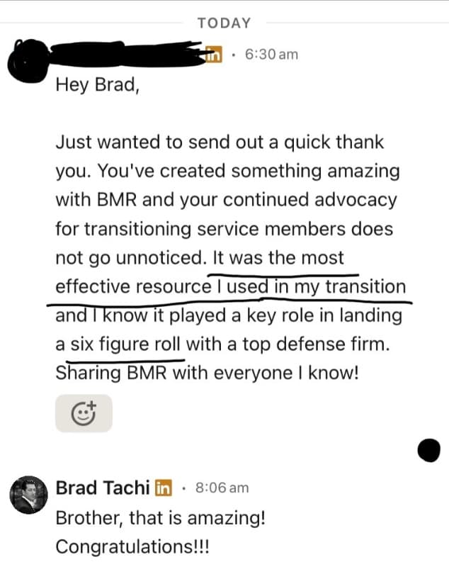
“Hey Brad, Just wanted to send out a quick thank you. You've created something amazing with BMR and your continued advocacy for transitioning service members does not go unnoticed. It was the most effective resource I used in my transition and I know it played a key role in landing a six figure…”
Dominic· Gunnery Sergeant (E-7)· Marines
→ Project ManagerFederal Career Paths
Federal hiring is a strong lane for 0241s because the entire GEOINT enterprise sits inside the federal government — NGA, NRO, DIA, CIA, and NSA all hire imagery analysts and geospatial specialists directly. Veterans Preference plus a current TS/SCI plus operational IMINT experience is a combination that civilian-only candidates cannot match.
GS Series Matches
0241s map to several federal series across intelligence, geography, science, and IT. Match strength depends on time in service and additional duties:
- GS-0132 Intelligence — The primary series for cleared analysts at NGA, DIA, NRO, NSA, CIA, and DoD intelligence components. Direct 1:1 fit. Typical entry: GS-9 to GS-12 for senior 0241s with operational production experience.
- GS-1370 Cartography — NGA, USGS, and federal mapping offices. Photogrammetric processing and GEOINT production background lines up. Typical: GS-7 to GS-11.
- GS-0150 Geography — Smaller series but a strong fit for 0241s with geospatial coursework. Used at NGA, DoD, and federal research agencies. Typical: GS-9 to GS-12.
- GS-1301 General Physical Science — Used for technical intelligence roles involving sensor science, physics-based exploitation, and MASINT-adjacent work. Typical: GS-9 to GS-12.
- GS-0855 Electronics Engineering — For 0241s who pivot toward sensor-systems engineering or work on the technical side of GEOINT collection. Requires engineering coursework or a solid technical portfolio. Typical: GS-7 to GS-12.
- GS-1550 Computer Science — Strong for 0241s who built scripting or automation skills around DCGS or geospatial data pipelines. Higher technical bar but pays well. Typical: GS-9 to GS-13.
- GS-2210 Information Technology Management — System administration, cybersecurity, and IT roles inside cleared intelligence environments. Pairs well with Security+ or CISSP. Typical: GS-9 to GS-12.
- GS-0301 Miscellaneous Administration and Program — Catch-all for senior 0241s with program coordination, training, and administrative responsibilities that do not fit a specialty series. Typical: GS-9 to GS-12.
- GS-1102 Contracting — For 0241s who pivot to acquisition work, especially on cleared GEOINT or intelligence contracts. Strong long-term federal track. Typical: GS-9 to GS-12.
Veterans Preference for 0241s
Most honorably discharged veterans qualify for 5-point preference, and disabled veterans qualify for 10-point preference, which moves applicants to the top of GS-9 and below registers. The preference matters but it does not write the resume for you. Federal applications use a different format and keyword vocabulary than the private sector — every duty needs hours per week, supervisor contact, GS-equivalent grade, and detailed responsibilities mapping to the qualification standard.
For the federal resume side, the intelligence series in particular is unforgiving with vague descriptions. Read the cleared intelligence civilian careers guide, or use the BMR federal resume builder to walk through it directly. The federal resume builder handles GS series formatting, qualification matching, and the supervisor-and-hours block that USAJobs rejects most veterans on.
GS Series & Position Matches
| GS Series | Federal Job Title | Typical Grades | Match | Explore |
|---|---|---|---|---|
| GS-1370 | Cartography | GS-7, GS-9, GS-11 | View Details → | |
| GS-0132 | Intelligence | GS-9, GS-11, GS-12 | View Details → | |
| GS-1226 | Design Patent Examiner | GS-7, GS-9 | View Details → | |
| GS-0150 | Geography | GS-7, GS-9, GS-11 | View Details → | |
| GS-1301 | General Physical Science | GS-9, GS-11, GS-12 | View Details → | |
| GS-1550 | Computer Science | GS-9, GS-11, GS-12, GS-13 | View Details → | |
| GS-2210 | Information Technology Management | GS-9, GS-11, GS-12 | View Details → | |
| GS-0301 | Miscellaneous Administration and Program | GS-9, GS-11, GS-12 | View Details → | |
| GS-1102 | Contracting | GS-9, GS-11, GS-12 | View Details → | |
| GS-0855 | Electronics Engineering | GS-7, GS-9, GS-11, GS-12 | View Details → |
Federal resumes follow different rules. We know them.
Federal hiring uses keyword-matching and structured experience. BMR builds federal-format resumes (USAJobs-ready) with the right keywords, hours/week, and supervisor info — for any GS series above.
Free to start · Federal + civilian resume formats included
Want to Change Careers Entirely?
Not everyone wants to stay in a related field. These career paths leverage your transferable skills — leadership, risk management, logistics, project planning — in completely different industries.
Data Analyst
$84,500
Technology / Commercial(O*NET: 15-2051.00)BLS OEWS May 202423% (Much faster than average)
data analysispattern identificationtime-series analysisstatistical reportingtool proficiency
IMINT exploitation is structured analytical production at its core. The DCGS workflow translates to enterprise data platforms, FMV exploitation translates to real-time analytics, and pattern-of-life work is exactly what behavioral analytics teams do.
How to get there: Pursue Google Data Analytics or CompTIA Data+ during your last 6 months in service. Apply to commercial data analyst roles or use SkillBridge with a tech company. Mid-level entry typical for senior 0241s.
Software Developer / Engineer
$130,160
Technology(O*NET: 15-1252.00)BLS OEWS May 202417% (Much faster than average)
scriptingautomationgeospatial data pipelinestechnical problem-solving
0241s who built scripting or automation skills around DCGS or geospatial data pipelines have a credible path into software roles, especially geospatial software work.
How to get there: Build a portfolio with Python, JavaScript, or Go. Bootcamps or self-study. Apply to commercial software roles or cleared software roles at IC contractors.
Operations Manager
$102,950
Government / Defense(O*NET: 11-1021.00)BLS OEWS May 20246% (Faster than average)
production managementquality controlteam leadershipprocess optimization
Senior 0241s have managed production cells, supervised analyst teams, and run quality control on intelligence products. Operations management work is the same skill set under different names.
How to get there: PMP or Six Sigma Green Belt accelerates the move. Apply to operations supervisor or program coordinator roles at major employers, then promote into management.
Project Manager / Program Manager
$98,580
Defense / Federal(O*NET: 11-3021.00)BLS OEWS May 20247% (Faster than average)
program coordinationtimeline managementstakeholder reportingresource planning
Senior 0241s with B-billet or staff time have run training programs, equipment management, and analytical production tracks. PM credentials translate that work directly.
How to get there: PMP through PMI. Many senior 0241s pivot to PM at defense contractors or federal acquisition tracks (GS-1101/1102).
Cybersecurity Analyst
$124,910
Defense / Technology(O*NET: 15-1212.00)BLS OEWS May 202433% (Much faster than average)
threat analysislog analysispattern identificationclearance
0241 analytical methodology applies directly to cyber threat hunting and SOC analyst work. The clearance plus analyst training opens cleared cyber roles fast.
How to get there: Security+ at minimum; CISSP for senior roles. Apply to cleared SOC, threat intelligence, or cyber analyst roles at major contractors. Strong upward salary curve.
Sales Engineer (Commercial GEOINT / Geospatial Tech)
$116,950
Commercial GEOINT / Software(O*NET: 41-9031.00)BLS OEWS May 20246% (Faster than average)
technical product knowledgecustomer-facing communicationcomplex solution explanation
Companies like Maxar, Planet, BlackSky, and Esri sell to federal customers and need sales engineers who understand the IC mission. 0241s have unmatched credibility there.
How to get there: Apply directly to commercial GEOINT companies for sales engineering roles. Strong base salary plus commission structure. The mission credibility is the differentiator.
Cartographer (Commercial)
$76,210
Commercial Mapping / GIS(O*NET: 17-1021.00)BLS OEWS May 20242% (Slower than average)
photogrammetryspatial analysismap productiondata visualization
Commercial mapping firms hire 0241s for photogrammetric processing and spatial analysis work. Smaller market but a clear translation.
How to get there: GISP credential helps. Esri certifications are useful. Apply to commercial mapping firms, surveying companies, or state/local GIS offices.
Pivoting industries? You don't need to start from scratch.
The skills that made you a good Marine, Sailor, Airman, or Soldier transfer further than you think. BMR rewrites your bullets for any of the pivot careers above — without making you sound like you've never done the work.
Free to start · Try unlimited career angles
Skills Translation Guide
If you are staying inside the IC or the cleared GEOINT contractor world, your terminology translates directly. Recruiters at Booz Allen, Leidos, BAE, Maxar, and the federal GEOINT agencies know DCGS, IMINT, GEOINT, and full-motion video exploitation. This section is for 0241s targeting careers OUTSIDE cleared intelligence — commercial GIS, software engineering, data analytics, project management, or operations roles in the private sector where IMINT means nothing.
Military-to-Civilian Language Translation
The 0241 vocabulary is dense and specialized to a small community. Civilian recruiters at a tech company, a commercial GIS firm, or a data analytics shop will not pattern-match on these terms unless they are translated. Key swaps:
- Imagery Analyst (0241) → Senior Geospatial / Imagery Data Analyst
- Imagery Analysis Cell / IAC → Geospatial Analysis Team
- IMINT (Imagery Intelligence) → Imagery-Derived Geospatial Intelligence Products
- GEOINT (Geospatial Intelligence) → Geospatial Analysis & Product Development
- Distributed Common Ground System (DCGS) → Enterprise Geospatial Production Platform
- Full-Motion Video (FMV) Exploitation → Real-Time Video & Sensor Data Analysis
- Multi-Spectral Imagery (MSI) Analysis → Multi-Band Sensor Data Analysis
- Synthetic Aperture Radar (SAR) → Specialized Radar-Derived Imaging Data
- Battle Damage Assessment (BDA) → Post-Event Analytical Assessment & Reporting
- Target Development → Subject-Focused Research & Analysis Production
- Pattern-of-Life Analysis → Behavioral Pattern Analytics & Trend Identification
- Change Detection → Time-Series Comparative Analysis
Resume Bullet Examples
Before (Military): Served as imagery analyst within the MAGTF Imagery Analysis Cell, conducting IMINT exploitation in support of operational and tactical commanders.
After (Civilian Geospatial Analyst): Produced 400+ geospatial intelligence products supporting senior decision-makers across a 10,000-personnel operational organization. Translated raw sensor data into actionable analytical reports under daily production deadlines.
Before (Military): Performed full-motion video exploitation supporting time-sensitive targeting and pattern-of-life analysis.
After (Civilian Data Analyst): Conducted real-time analysis of streaming sensor data feeds to identify behavioral patterns and trend anomalies. Delivered findings to senior leadership within 60-minute decision cycles across 24/7 operational tempo.
Before (Military): Operated DCGS for production of finished GEOINT products consumed across the Defense Intelligence Enterprise.
After (Civilian GIS Analyst): Built and published geospatial analytical products on enterprise data platform serving 5,000+ stakeholders across a federated organizational network. Maintained 99%+ on-time delivery against established quality and accuracy standards.
For the broader translation playbook, read 50 Military Terms Translated to Civilian Language. Or skip ahead and let the BMR military resume builder handle the translation work.
Resume Bullet Examples
Before (Military)
Produced IMINT products supporting MAGTF operations.
After (Civilian)
Produced imagery-derived analytical products supporting senior decision-makers across a 10,000-personnel operational organization.
Before (Military)
Conducted GEOINT exploitation for theater commanders.
After (Civilian)
Conducted geospatial analysis and produced finished products for senior leadership across a federated operational network.
Before (Military)
Operated DCGS for daily production of intelligence products.
After (Civilian)
Operated enterprise data and analytical production platform supporting daily delivery of analytical products to 5,000+ stakeholders.
Before (Military)
Performed FMV exploitation supporting time-sensitive operations.
After (Civilian)
Conducted real-time analysis of streaming sensor data feeds to identify behavioral patterns and trend anomalies, delivering findings within 60-minute decision cycles.
Before (Military)
Analyzed MSI data for change detection and pattern-of-life development.
After (Civilian)
Analyzed multi-band sensor data sets to detect changes over time and identify trend patterns supporting analytical reporting.
Before (Military)
Produced BDA reports for senior commanders within 24 hours of operations.
After (Civilian)
Produced post-event analytical assessments delivered to senior leadership within 24-hour reporting cycles, informing follow-on operational decisions.
Before (Military)
Built target packages including pattern-of-life analysis and disposition.
After (Civilian)
Conducted in-depth research and analytical production on priority subjects, including behavioral pattern analysis and structured analytical reporting.
Before (Military)
Built pattern-of-life products from multi-INT sources.
After (Civilian)
Identified behavioral patterns and trends across multiple data streams to inform decision-makers on emerging risks and opportunities.
Before (Military)
Performed change detection across multi-temporal imagery datasets.
After (Civilian)
Conducted time-series comparative analysis across large datasets to identify changes and trends supporting decision-maker reporting.
Before (Military)
Maintained TS/SCI clearance throughout 6-year service.
After (Civilian)
Active Top Secret / Sensitive Compartmented Information (TS/SCI) clearance, eligible for full-scope or counterintelligence polygraph.
Get bullets like these auto-generated for your resume.
BMR turns your 0241 duties and accomplishments into civilian bullets that match the job you're applying for — no manual translation, no rewriting.
Free to start · Tailored to each job posting
Certifications by Career Path
Which certifications you need depends on where you're headed. Find your target career path below.
Cloud Computing
AWS Certified Cloud Practitioner
RecommendedAmazon Web Services
Cost: $100Time: 4-8 weeksGI Bill Eligible
Entry cloud credential. NGA, NRO, and major contractors run extensive AWS GovCloud workloads.
AWS Certified Solutions Architect - Associate
RecommendedAmazon Web Services
Cost: $150Time: 8-12 weeksGI Bill Eligible
Mid-level cloud credential. Strong fit for 0241s pivoting to cloud-adjacent technical roles.
Cybersecurity
CompTIA Security+
RecommendedCompTIA
Cost: $400-$500Time: 4-8 weeksGI Bill Eligible
Required for many cleared IT and analyst roles operating on DoD networks. Pairs well with TS/SCI.
CISSP (Certified Information Systems Security Professional)
RecommendedISC2
Cost: $750Time: 3-6 monthsGI Bill Eligible
Senior-level cybersecurity credential for cleared analysts pivoting to information security roles.
Data Analytics
CompTIA Data+
RecommendedCompTIA
Cost: $250-$350Time: 6-10 weeksGI Bill Eligible
Vendor-neutral data analytics credential. Useful for 0241s pivoting to broader analyst roles.
Google Data Analytics Professional Certificate
OptionalGoogle / Coursera
Cost: $49/month subscriptionTime: 3-6 months
Entry-level data analytics credential. Useful for transitioning to commercial data analyst roles.
Defense Contracting
Defense Acquisition Workforce Improvement Act Cert (DAWIA)
OptionalDefense Acquisition University
Cost: Free (DoD employees)Time: Varies
Some 0241s on B-billet or staff assignments earn DAWIA credentials. Useful for federal contracting series transitions.
Federal Employment
Federal Acquisition Certification (FAC-C / DAWIA)
OptionalOPM / DAU
Cost: Free for federal employeesTime: Varies (training-based)
Earned by some senior 0241s in federal acquisition tracks. Path to GS-1102 Contracting series.
GIS & Geospatial
GISP (Geographic Information Systems Professional)
Highly RecommendedGIS Certification Institute (GISCI)
Cost: $250 application + experience requirementTime: 6+ months (experience-based)
Strongest credential for moving into commercial GIS work outside cleared environments.
Esri Technical Certifications (ArcGIS)
RecommendedEsri
Cost: $225-$250 per examTime: 2-4 months prepGI Bill Eligible
Vendor certifications for ArcGIS Desktop, ArcGIS Pro, and Enterprise. Reads well on civilian GIS resumes.
Intelligence & Analysis
USGIF GEOINT Professional Certification (GPC I/II/III)
Highly RecommendedUnited States Geospatial Intelligence Foundation (USGIF)
Cost: $300-$1,500Time: 3-9 monthsGI Bill Eligible
Industry-standard credential for the GEOINT community. Recognized across IC and contractor hiring.
Project Management
PMP (Project Management Professional)
RecommendedProject Management Institute (PMI)
Cost: $400-$700 + study materialsTime: 3-6 monthsGI Bill Eligible
Strong long-term credential for senior 0241s targeting program management tracks at contractors or federal agencies.
Six Sigma Green Belt
OptionalASQ / IASSC
Cost: $295-$1,000Time: 2-4 monthsGI Bill Eligible
Process improvement credential. Useful for management track pivots into operations roles.
Got a cert? Don't bury it. List it the right way.
The wrong placement can sink an otherwise strong application. BMR knows where each cert ranks, what to call it, and how to frame it for ATS keyword matching and hiring manager attention.
Free to start · Built around your real certs and clearance
Transition Resources
Staying in the Field (IC / Cleared GEOINT)
- Defense Contractor SkillBridge programs — Booz Allen Hamilton, Leidos, BAE Systems, CACI, and Peraton all run SkillBridge fellowships during your last 180 days of service. These are paid internships with strong conversion rates into full-time cleared analyst roles. See SkillBridge Resume That Gets You Accepted and Hired.
- NGA Direct Hiring — The National Geospatial-Intelligence Agency runs dedicated military-transition hiring tracks. Apply through USAJobs.gov filtering for NGA. The TS/SCI plus operational GEOINT experience often qualifies senior 0241s for GS-11 or GS-12 entry.
- NRO Careers — National Reconnaissance Office hiring is also USAJobs-routed. Smaller workforce, harder to break into, but pays at the high end of the GS scale and puts you on the technical side of imagery collection.
- USGIF (United States Geospatial Intelligence Foundation) — Industry association for the GEOINT community. Conferences, certifications (USGIF Universal GEOINT Certification), and networking are all valuable.
- Defense Contractor Jobs guide — Read Defense Contractor Jobs for Senior Veterans With Clearance for a full breakdown of the cleared lane.
Careers Outside the Field (Commercial GIS / Tech / Data)
- SkillBridge / Transition Assistance — Mandatory pre-separation for Marines is the Transition Readiness Seminar (TRS). Use it to start applications early. Read about the broader transition assistance landscape.
- USAJobs.gov — Federal application portal. Set up saved searches for the GS series listed in this guide.
- GISP Certification — Geographic Information Systems Professional credential through GISCI. Strongest credential for moving into commercial GIS work outside cleared environments.
- Esri Technical Certifications — Esri (the makers of ArcGIS) runs technical certifications that read well on civilian GIS resumes. GI Bill eligible in many cases.
- Salary expectations — Read Military to Civilian Salary: What You're Worth for benchmarks across cleared and commercial roles.
BMR Tools for 0241s
- Build your free 0241 tailored resume — AI translates your DCGS, IMINT, FMV, and GEOINT production experience into civilian language automatically.
- Military Resume Builder — Full builder with cover letters, LinkedIn optimization, and elevator pitches.
- Federal Resume Builder — USAJobs-formatted resumes for the GS series above.
- Career Translation Hub — Browse all branches and MOS guides.
See Also
- 0231 Intelligence Specialist — Closest Marine Corps intel partner.
- 2621 Special Communications Signals Collection — Marine SIGINT path with similar IC destinations.
- Army 35N Signals Intelligence Analyst — Cross-branch SIGINT cousin.
- Army 35L Counterintelligence Agent — CI lane with overlapping IC destinations.
- Navy CTI Cryptologic Technician Interpretive — Cross-branch language/SIGINT cousin.
- Navy CTT Cryptologic Technician Technical — Technical SIGINT cross-branch path.
- Air Force 1N0X1 All Source Intelligence Analyst — All-source cross-branch analyst path.
Your 30 / 60 / 90-Day Transition Plan
Most people do this backwards. They wait until terminal leave to start, then panic. Here's the sequence that works. Already out? Same plan, start at day one today.
1Days 0–30
Set the foundation
- Pull your DD-214 (request from Milconnect if separated)
- List your top 3 civilian roles AND top 3 GS series
- Build your tailored 0241 resume — BMR does it free
- Write 1 strong LinkedIn headline (not "veteran seeking opportunities")
- Pull together your evals/performance reports for accomplishments
2Days 30–60
Apply with intent
- Apply to 5–10 jobs/week — quality over quantity
- Tailor every resume to the job description (BMR auto-tailors)
- Connect with 5 people/week on LinkedIn (not a spray)
- Set up a USAJobs profile and a saved-search alert for your GS series
- Practice translating your military bullets out loud — explain to a civilian friend
3Days 60–90
Close the offer
- Track every application — date, status, contact, notes
- Follow up 7–10 days after each application
- Prep for behavioral interviews using the STAR method
- Negotiate salary — don't take the first offer (BLS median is your floor)
- Stay applying even after one offer — leverage = options
Print this. Tape it to your monitor. Veterans who treat the job search like a 90-day op get hired faster than the ones who treat it like an emergency.
Frequently Asked Questions
What civilian jobs hire Marine 0241 Imagery Analysis Specialists?
The strongest direct paths are NGA, NRO, DIA, CIA, and NSA federal hiring, plus cleared defense contractors (Booz Allen Hamilton, Leidos, BAE Systems, CACI, Peraton, SAIC, Amentum, Lockheed Martin, Northrop Grumman) holding GEOINT contracts, plus commercial GEOINT companies (Maxar Technologies, Planet Labs, BlackSky). Common civilian titles include cleared imagery analyst, geospatial information scientist, targeting analyst, GEOINT analyst, and geospatial data analyst.
How much do 0241s make in civilian jobs?
BLS median salaries for the related occupations: cartographer/photogrammetrist $76,210, geospatial information scientist $85,220, geographer $90,880, business operations specialist (cleared analyst) $89,170. With an active TS/SCI clearance, 0241s typically see offers $80K to $130K from defense contractors, often higher in the National Capital Region and at senior levels. Federal GS-12 with locality (NCR) pays roughly $103K to $134K depending on step.
How valuable is a TS/SCI clearance from 0241 work?
Very. TS/SCI is one of the most expensive and time-consuming clearances to grant — employers commonly value it at $50K to $100K because of the wait and cost to clear a candidate from scratch. The clearance stays current for 24 months after separation, longer if you continue cleared work without a break. List it prominently on your resume and LinkedIn. The clearance is what creates the hiring lane with very little competition.
Should I go straight to NGA or take a contractor offer first?
Both work. Going straight to NGA via USAJobs gives you federal stability, Veterans Preference, and a direct seat at the agency. Going contractor first often pays more in years 1-3 and gives you the option to convert to federal later via a 1101/1102/0132 series posting. Many 0241s do contractor for 3-5 years, then move to federal for the long-term stability. Both paths are legitimate and the choice usually comes down to immediate financial needs versus long-term career arc.
What certifications should I get before separating?
Inside the IC / cleared lane: USGIF Universal GEOINT Certification (GEOINT Professional Certification I/II/III) is the most directly relevant credential. Outside cleared work: GISP through GISCI for commercial GIS roles, Esri ArcGIS technical certifications for tooling depth, and Security+ if you want to move into IT or cybersecurity-adjacent roles. PMP becomes valuable for senior 0241s targeting program management tracks.
Can I use my GI Bill for a GIS certificate or master's?
Yes. GI Bill covers university GIS certificates, master's programs in geospatial science, and many vendor certifications including Esri courses and select USGIF programs. NGA also runs tuition assistance for federal GS employees, so transitioning to NGA first and using their tuition program is a path some 0241s take to build a master's on top of the GI Bill.
How do I write a federal resume for the GS series in this guide?
Federal resumes follow specific format requirements: 2 pages target length (modern best practice), every job needs hours per week worked, supervisor name and contact, GS-equivalent grade level, and detailed duty descriptions matching the GS series qualification standards. Use the BMR federal resume builder to walk through formatting, or read the cleared intelligence careers guide for series-specific tips.
Where do most 0241s end up after separating?
There is no single dominant path because the IC and contractor markets are large and varied. The largest concentrations land at NGA (because the technical fit is strongest), at major contractors holding NGA, NRO, or DIA contracts (because clearance plus operational experience is the rarest combination), and at commercial GEOINT firms like Maxar, Planet Labs, and BlackSky for those who want a less rigid environment. Some 0241s leave the field entirely for commercial GIS or data analytics — that is a legitimate path too.
What if I want to leave intelligence work entirely?
The career pivots in this guide cover that — commercial GIS analyst, data analyst, software engineering, project management, and operations management. The skills are highly transferable; the resume just has to do the translation work. The DCGS workflow translates to enterprise data platforms, FMV exploitation translates to real-time data analytics, and target development translates to research and analytical production. Read the Military to Civilian Salary guide for broader benchmarks.
Does BMR support 0241s specifically?
Yes. BMR has built more than 55,000 resumes across every MOS, including dozens of 0241s. The AI knows DCGS, IMINT, GEOINT, FMV exploitation, MSI, SAR, target development, and pattern-of-life analysis terminology, and translates all of it into civilian language tailored to the specific job you are applying for. Free for every veteran — 2 tailored resumes, 2 cover letters, LinkedIn optimization, all included. <a href="/" class="text-blue-600 dark:text-blue-400 font-medium no-underline hover:underline">Get started here</a>.
Salary data from U.S. Bureau of Labor Statistics, Occupational Employment and Wage Statistics (OEWS), May 2024. Career data from O*NET OnLine.
Free for every veteran
Translate your 0241 Imagery Analysis Specialist experience into a resume that gets callbacks
Stop rewriting from scratch every time you apply. BMR turns your military experience into civilian and federal resumes — tailored to each job.
What you get — all free:
2
Tailored resumes
AI-rewritten for each job posting
2
Cover letters
Matched to the role
∞
LinkedIn optimization
Profile rewrite for civilian recruiters
∞
Elevator pitch generator
For interviews and networking
2
Company research reports
Know who you're applying to
∞
Job tracker
Manage every application in one place
Start My Free Resume
Free to start · 90 seconds to sign upBuilt by a Navy Diver veteran. More than 65,000 resumes built for the military community.