Loading...
MarinesMOS: 0261
Geographic Intelligence Specialist
The civilian and federal jobs that hire Marines Geographic Intelligence Specialists — with real salaries and the resume that gets callbacks.
Every 0261 has more options than a Google search will tell you. Below: career paths, BLS salary data, federal GS series, certifications by target career, and how to translate your experience without losing what made you valuable to the Marines in the first place.
Free to start · Tailored resume in under 5 minutes
$52K–$125K
Salary Range
BLS-verified median salaries
14
Career Paths
13
Companies Hiring
9
Resume Examples
7
Federal GS Series
6
Certification Paths
10
FAQs Answered
BT
Brad Tachi
Navy Diver · BMR Founder
After the Navy I got hired into 6 federal career fields and tech sales, and sat on federal hiring panels along the way. I spent the last 2 years rebuilding everything I learned into BMR, tuned for how AI actually screens resumes today. This is the system I wish I'd had on day one.
60,000+ resumes built·Success stories every week
Military Role Overview
If you held the 0261 MOS, you built the picture everyone else fought from. Geographic Intelligence Specialists plan, process, analyze, and disseminate spatial data so commanders understand the operational environment before a single Marine steps off. You ran precision ground control surveys to feed positional data to weapons and command-and-control systems, built and revised military maps and charts, conducted geodetic, topographic, and hydrographic survey operations, and analyzed terrain and hydrography as a function of intelligence.
The toolset is the part civilian employers recognize fastest. You worked in Geographic Information Systems (GIS), exploited remotely sensed imagery (RSI), and ran survey and positioning instrumentation from theodolites to satellite positioning gear. The training pipeline runs roughly seven months at Dam Neck, Virginia, and the seat requires eligibility for a Top Secret clearance with access to Sensitive Compartmented Information. That clearance plus hands-on GIS production is a combination the commercial and federal geospatial market pays real money for.
Employers value this background because GEOINT is no longer a niche. Logistics companies route fleets with it, utilities map their grids with it, insurers price flood risk with it, and every level of government plans with it. The 0261 who can turn raw imagery and survey data into a decision-ready product is doing the exact work civilian GIS analysts and cartographers do, often with deeper field-survey experience than a degree-only hire brings. If you are weighing where your skills land, start with the military career crosswalk tool, and compare notes with the closely related 0241 Imagery Analysis Specialist and 0231 Intelligence Specialist paths.
BMR has built more than 60,000 resumes across every branch and code, and 0261s are one of the cleaner translations I see. The GIS production and clearance carry over almost word for word. What costs you interviews is leaving "geodetic survey" and "RSI exploitation" in military shorthand instead of writing them as the GIS, cartography, and geospatial analysis work civilian hiring managers already budget for. — Brad Tachi, Navy Diver veteran & BMR founder
Security ClearanceTop Secret/SCI
ASVAB RequirementEL: 100
TrainingApproximately 7 months of GEOINT training at Dam Neck, Virginia, covering GIS, survey operations, cartography, and imagery analysis.
Certs Earned in ServiceGIS production proficiency (ArcGIS), Geodetic and topographic survey operations, Remotely sensed imagery (RSI) exploitation
Pay Reality Check
The number that matters when you're deciding what's next: how does civilian pay compare to what you make now?
Marines mid-career
$58K–$82K
E-5 to E-7 total comp (base + BAH + BAS + tax advantage)
Civilian Geographic Intelligence Specialist
$52K–$99K
BLS median across direct-match civilian roles
Federal (GS-9 to GS-13)
$58K–$120K
7 matching GS series + locality pay + step increases
+20% on average
Civilian roles for Geographic Intelligence Specialists pay ~$14K more than mid-career enlisted total comp.
Military comp is approximate (varies by location/dependents). Civilian is BLS median. Federal includes locality pay. Your real number depends on duty station, family status, GS step, and overtime.
Private Sector Career Paths
The geospatial field is one of the better-paying technical destinations open to transitioning Marines, and demand spans private industry, not just defense. Salary figures below are BLS Occupational Employment and Wage Statistics medians, May 2024.
Cartographers and Photogrammetrists (O*NET 17-1021.00) earn a median of $78,380. This is the closest one-to-one match to map and chart production work, and your photogrammetry and imagery-exploitation reps line up directly. Geographers (O*NET 19-3092.00) sit at a $97,200 median for analysts who turn spatial data into research and planning products. Surveyors (O*NET 17-1022.00) earn $72,740 and Surveying and Mapping Technicians (O*NET 17-3031.00) earn $51,940, both natural fits for the precision ground control survey side of the house. Geoscientists (O*NET 19-2042.00), at a $99,240 median, hire GEOINT veterans who pair terrain analysis with environmental and geological datasets.
Be honest with yourself about the market. The highest pay clusters in metro areas with defense, energy, and tech employers, and the deepest commercial GIS hiring sits around Washington D.C., Denver, Huntsville, and the major tech hubs. Outside those, GIS work exists but skews toward government and utilities at lower bands. Geographers is a small occupation, so the openings are competitive even though the median is high. If you want to stay close to the field but in industry, defense contractors and commercial imagery firms are where your clearance keeps paying.
For roles that blend GIS with broader analysis, the intel-to-data-analytics path is worth reading. Marines who want to compare how a sister-service analyst frames the same skills can look at the Army 35G Geospatial Intelligence Imagery Analyst and Air Force 1N1X1 Geospatial Intelligence pages. When you are ready to put it on paper, the military resume builder turns these duties into civilian bullets.
Civilian Job Title Translations
| Civilian Job Title | Industry | BLS Median Salary | Outlook | Match |
|---|---|---|---|---|
Cartographer / Photogrammetrist O*NET: 17-1021.00 | Geospatial | $78,380 | Faster than average | strong |
GIS Analyst O*NET: 15-1299.02 | Geospatial | $78,380 | Steady demand across industries | strong |
Geographer O*NET: 19-3092.00 | Research & Planning | $97,200 | Little change | moderate |
Surveyor O*NET: 17-1022.00 | Surveying & Mapping | $72,740 | Faster than average | strong |
Surveying & Mapping Technician O*NET: 17-3031.00 | Surveying & Mapping | $51,940 | Faster than average | strong |
Geoscientist O*NET: 19-2042.00 | Energy & Environmental | $99,240 | Faster than average | moderate |
Remote Sensing Analyst O*NET: 19-3092.00 | Geospatial | $97,200 | Steady demand | moderate |
Intelligence / GEOINT Analyst (Contractor) O*NET: 33-3021.00 | Defense | $99,430 | Steady cleared demand | strong |
Cartographer / Photogrammetrist
Geospatial
$78,380median
Faster than average
O*NET: 17-1021.00
GIS Analyst
Geospatial
$78,380median
Steady demand across industries
O*NET: 15-1299.02
Geographer
Research & Planning
$97,200median
Little change
O*NET: 19-3092.00
Surveyor
Surveying & Mapping
$72,740median
Faster than average
O*NET: 17-1022.00
Surveying & Mapping Technician
Surveying & Mapping
$51,940median
Faster than average
O*NET: 17-3031.00
Geoscientist
Energy & Environmental
$99,240median
Faster than average
O*NET: 19-2042.00
Remote Sensing Analyst
Geospatial
$97,200median
Steady demand
O*NET: 19-3092.00
Intelligence / GEOINT Analyst (Contractor)
Defense
$99,430median
Steady cleared demand
O*NET: 33-3021.00
Companies That Hire This Background
The federal home of GEOINT; hires cartography, geography, and GS-0132 intelligence analysts directly.
Maker of ArcGIS; hires GIS analysts and solution engineers and runs veteran training paths.
Commercial satellite imagery and geospatial intelligence; values cleared RSI and GEOINT backgrounds.
Geospatial intelligence and analysis programs; cleared GEOINT analysts in high demand.
Large GEOINT and intelligence services contractor staffing NGA and combatant command billets.
Geospatial analytics and intelligence consulting; clearance-forward hiring.
Federal cartography, geography, and geoscience roles; strong fit for survey and mapping skills.
Geospatial and survey data company; hydrographic and geodetic survey experience valued.
Earth-imaging and remote sensing company hiring imagery and geospatial analysts.
State DOTs, county GIS offices, and utilities staff GIS analysts and mapping technicians nationwide.
Hydrographic survey and geospatial work; strong fit for the survey and charting side of 0261.
See a salary you want? Build a resume targeting it.
BMR rewrites your 0261 experience for any of the civilian roles above — keywords, achievements, and language hiring managers actually scan for.
Free to start · 2 tailored resumes included
Real Marines success story
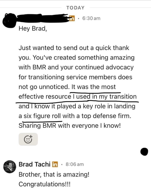
“Hey Brad, Just wanted to send out a quick thank you. You've created something amazing with BMR and your continued advocacy for transitioning service members does not go unnoticed. It was the most effective resource I used in my transition and I know it played a key role in landing a six figure…”
Dominic· Gunnery Sergeant (E-7)· Marines
→ Project ManagerFederal Career Paths
Federal service is where a clearance and GEOINT production background can move you to a GS grade faster than the private sector would title you. The agencies that consume geospatial intelligence (NGA, NRO, the combatant commands, and dozens of DoD components) staff these series constantly.
The GS-1370 Cartography series is the direct hit for map and chart production, with GEOINT veterans commonly qualifying at GS-7 through GS-11 depending on degree and years. GS-0150 Geography covers spatial analysis and research roles. GS-1372 Geodesy and GS-1373 Land Surveying map to the precision survey and positional-data work, and GS-1301 General Physical Science picks up the broader technical analyst positions. The intelligence side runs through GS-0132 Intelligence, which is where the GEOINT analyst billets at NGA and the commands live, and where your TS/SCI is a qualifying credential, not a nice-to-have.
Veterans' Preference adds 5 or 10 points to your rated score and, more importantly, opens hiring authorities like VRA and the 30 percent disabled authority that let agencies appoint you outside the standard competitive process. Read how 5 and 10-point preference actually works and the GS-0132 intelligence series resume guide before you apply. Marines targeting the same GS series as other branches can cross-reference the Army 12Y Geospatial Engineer federal section. A USAJobs federal resume reads nothing like a civilian one, so build it with the federal resume builder.
GS Series & Position Matches
| GS Series | Federal Job Title | Typical Grades | Match | Explore |
|---|---|---|---|---|
| GS-1370 | Cartography | GS-7, GS-9, GS-11 | View Details → | |
| GS-0150 | Geography | GS-9, GS-11, GS-12 | View Details → | |
| GS-0132 | Intelligence | GS-9, GS-11, GS-12 | View Details → | |
| GS-1372 | Geodesy | GS-7, GS-9, GS-11 | View Details → | |
| GS-1301 | General Physical Science | GS-9, GS-11 | View Details → | |
| GS-0193 | Archeology | GS-7, GS-9 | View Details → | |
| GS-1373 | Land Surveying | GS-7, GS-9 | View Details → |
Federal resumes follow different rules. We know them.
Federal hiring uses keyword-matching and structured experience. BMR builds federal-format resumes (USAJobs-ready) with the right keywords, hours/week, and supervisor info — for any GS series above.
Free to start · Federal + civilian resume formats included
Want to Change Careers Entirely?
Not everyone wants to stay in a related field. These career paths leverage your transferable skills — leadership, risk management, logistics, project planning — in completely different industries.
Urban and Regional Planner
$83,720
Government and Civic Planning(O*NET: 19-3051.00)BLS OEWS May 2024Faster than average
Spatial analysis and land-use mappingInterpreting demographic and geographic datasetsTranslating technical data into planning recommendationsGIS-based scenario modeling
City and regional planning leans heavily on the same spatial analysis and GIS skills you used to read terrain, just applied to zoning, transit, and land use instead of operations.
How to get there: A master's in urban or regional planning is the common entry, though GIS-heavy planning technician roles hire on experience plus a bachelor's. The AICP credential accelerates advancement.
Environmental Scientist
$80,060
Environmental Services(O*NET: 19-2041.00)BLS OEWS May 2024Faster than average
Terrain and environmental data fusionField data collection and survey rigorSpatial mapping of environmental conditionsQuality control of measurement data
Your terrain analysis and field-survey discipline transfer to mapping contamination, habitat, and resource data, where GIS skills are in constant demand.
How to get there: A bachelor's in environmental or earth science is the standard entry. GIS experience makes you immediately useful on the geospatial side of consulting and agency work.
Operations Research Analyst
$91,290
Business and Logistics(O*NET: 15-2031.00)BLS OEWS May 2024Much faster than average
Quantitative analysis of complex datasetsModeling spatial and logistical problemsTranslating data into decision recommendationsWorking to precision and deadline standards
The analytical rigor you applied to spatial intelligence problems is the same skill operations research uses to optimize routing, supply, and resource allocation.
How to get there: A bachelor's in a quantitative field plus demonstrated analytical work gets you in; a master's opens senior roles. Your modeling and data work is the bridge.
Information Security Analyst
$124,910
Cybersecurity(O*NET: 15-1212.00)BLS OEWS May 2024Much faster than average
Active TS/SCI clearancePattern recognition and anomaly analysisWorking within classified systems and protocolsDisciplined attention to data integrity
Your clearance and your trained eye for anomalies in large datasets transfer well to threat analysis, and cleared cyber roles pay a premium for both.
How to get there: A Security+ certification plus your clearance opens entry cyber roles. Many veterans bridge in through DoD 8140-aligned certs while keeping their clearance active.
Civil Engineer
$99,590
Infrastructure and Construction(O*NET: 17-2051.00)BLS OEWS May 2024Faster than average
Survey-grade positional measurementReading and producing technical site dataApplying published accuracy and tolerance standardsCoordinating field and technical teams
The precision survey and positional-data work you did for weapons systems is the same measurement foundation civil engineering projects depend on.
How to get there: A bachelor's in civil engineering is required to be licensed, but your survey background is a strong entry into engineering technician and survey-engineering roles while you pursue the degree.
Landscape Architect
$79,660
Design and Land Development(O*NET: 17-1012.00)BLS OEWS May 2024Faster than average
Terrain and site spatial analysisGIS-based site assessmentTranslating geographic constraints into designProducing precise technical drawings
Site analysis in landscape architecture starts with reading terrain and spatial constraints, exactly the lens you developed analyzing ground for operations.
How to get there: A bachelor's or master's in landscape architecture plus state licensure (LARE exam) is the path. Your GIS and terrain skills shorten the learning curve on the analysis side.
Pivoting industries? You don't need to start from scratch.
The skills that made you a good Marine, Sailor, Airman, or Soldier transfer further than you think. BMR rewrites your bullets for any of the pivot careers above — without making you sound like you've never done the work.
Free to start · Try unlimited career angles
Skills Translation Guide
If you are staying in GIS, cartography, or geospatial intelligence, your terminology translates directly. GIS, photogrammetry, georectification, and RSI are the same words those employers use every day. This section is for Marines targeting careers OUTSIDE the geospatial specialty, where 0261 jargon needs to become plain business language.
The pattern that costs interviews is leaving acronyms on the page. A hiring manager outside the field does not know what "geodetic ground control survey" means, but they understand "collected and verified high-precision positional data to a published accuracy standard." Translate the work, not just the title.
- "Exploited RSI to produce terrain analysis products" becomes "Analyzed satellite and aerial imagery to produce decision-ready reports for senior leadership."
- "Maintained GIS geodatabases and produced MGRS-gridded products" becomes "Built and maintained spatial databases and delivered standardized mapping products on deadline."
- "Conducted hydrographic survey operations" becomes "Collected and quality-controlled field measurement data in demanding outdoor conditions."
The clearance itself is a selling point in any field, so say it plainly. For more before-and-after examples, the 50 military terms translated to civilian language glossary and the hidden military skills civilians overlook guide both help. You can build your resume now if you would rather not stare at a blank page.
Resume Bullet Examples
Before (Military)
Exploited RSI to produce terrain analysis products supporting mission planning
After (Civilian)
Analyzed satellite and aerial imagery to produce decision-ready reports for senior leadership
Before (Military)
Maintained GIS geodatabases and produced MGRS-gridded mapping products
After (Civilian)
Built and maintained spatial databases and delivered standardized mapping products on deadline
Before (Military)
Conducted geodetic ground control surveys to feed positional data to C3 systems
After (Civilian)
Collected and verified high-precision positional data to a published accuracy standard
Before (Military)
Conducted hydrographic survey operations in support of amphibious planning
After (Civilian)
Collected and quality-controlled field measurement data in demanding outdoor conditions
Before (Military)
Constructed and revised military maps and charts to current accuracy standards
After (Civilian)
Produced and updated maps and data visualizations to organizational quality standards
Before (Military)
Performed terrain analysis to assess mobility corridors and obstacles
After (Civilian)
Assessed geographic and environmental data to inform planning and risk decisions
Before (Military)
Disseminated GEOINT products to supported commands under tight timelines
After (Civilian)
Delivered analytical products and briefings to stakeholders under deadline pressure
Before (Military)
Held TS/SCI clearance for access to compartmented intelligence systems
After (Civilian)
Active Top Secret/SCI clearance (transferable to cleared civilian and federal roles)
Before (Military)
Verified survey products met established positional accuracy standards
After (Civilian)
Applied rigorous quality assurance to ensure data accuracy and integrity
Get bullets like these auto-generated for your resume.
BMR turns your 0261 duties and accomplishments into civilian bullets that match the job you're applying for — no manual translation, no rewriting.
Free to start · Tailored to each job posting
Certifications by Career Path
Which certifications you need depends on where you're headed. Find your target career path below.
Data Analytics
Google Data Analytics Professional Certificate
RecommendedGoogle / Coursera
Cost: Check current pricingTime: 3-6 months
Bridges GEOINT analysis into broader data analytics roles.
Tableau Desktop Specialist
RecommendedTableau / Salesforce
Cost: Check current pricingTime: 1-2 months
Data visualization skill that complements spatial analysis for analyst roles.
Federal Employment
GS Federal Resume / USAJobs readiness
RecommendedSelf-study (OPM standards)
Cost: FreeTime: 1-2 weeks
Federal resumes follow OPM rules unlike civilian ones; preparation is what gets you referred.
GIS & Geospatial
GISP (GIS Professional)
RecommendedGIS Certification Institute (GISCI)
Cost: Check current pricingTime: 6-12 months (portfolio-based)GI Bill Eligible
Increasingly requested by employers; portfolio plus exam path.
Esri ArcGIS Technical Certifications
RecommendedEsri
Cost: Check current pricingTime: 1-3 months per exam
Validates hands-on ArcGIS production skill that employers screen for.
ASPRS Certified Photogrammetrist
RecommendedASPRS
Cost: Check current pricingTime: Varies (experience-based)
Direct credential for the photogrammetry side of map production.
ASPRS Certified Mapping Scientist - Remote Sensing
RecommendedASPRS
Cost: Check current pricingTime: Varies (experience-based)
Recognizes RSI and remote sensing expertise for imagery roles.
FAA Part 107 Remote Pilot (sUAS)
RecommendedFAA
Cost: Check current pricingTime: 2-4 weeks of study
Drone-based mapping is a growing GIS sub-field; this is the legal credential to fly commercially.
Fundamentals of Surveying (FS) Exam
RecommendedNCEES
Cost: Check current pricingTime: First step toward PS licensureGI Bill Eligible
Entry exam on the path to a licensed Professional Surveyor (PS).
Intelligence & Analysis
Security Clearance (maintain TS/SCI)
CriticalDoD / sponsoring employer
Cost: Employer-sponsoredTime: Maintained while billeted
Keeping your clearance current is the single highest-leverage credential for cleared GEOINT work.
GEOINT Professional Certification (GPC)
RecommendedUSGIF
Cost: Check current pricingTime: 3-6 months
Industry GEOINT credential recognized across the intelligence community.
Operations Management
Lean Six Sigma Green Belt
OptionalVarious (ASQ, IASSC)
Cost: Check current pricingTime: 2-4 monthsGI Bill Eligible
Process-improvement credential useful for analyst and operations pivots.
Project Management
PMP (Project Management Professional)
RecommendedPMI
Cost: Check current pricingTime: 3-6 monthsGI Bill Eligible
Opens program and project coordination roles for those leaving the technical track.
Got a cert? Don't bury it. List it the right way.
The wrong placement can sink an otherwise strong application. BMR knows where each cert ranks, what to call it, and how to frame it for ATS keyword matching and hiring manager attention.
Free to start · Built around your real certs and clearance
Transition Resources
Wherever you are headed, line up the right resources before you separate.
For Staying in Geospatial & GIS
Esri, the company behind ArcGIS, runs free and discounted training and a veteran path into the GIS community, and the GIS Certification Institute (GISCI) offers the GISP credential that employers increasingly ask for. The American Society for Photogrammetry and Remote Sensing (ASPRS) certifies photogrammetrists and remote sensing professionals, and the URISA association is the main professional network for GIS practitioners. SkillBridge internships with geospatial firms and defense contractors let you start before your EAS date.
For Careers Outside Geospatial
If you are pivoting away from GIS, lean on your clearance and your analytical record. The PMP from PMI and Six Sigma certifications open operations and analyst roles, and American Corporate Partners (ACP) pairs transitioning veterans with civilian mentors for free. Use the BMR career crosswalk tool to scope fields you have not considered, and run your SFL-TAP timeline through the SFL-TAP transition checklist.
See also the related Army 35F Intelligence Analyst and Navy Intelligence Specialist (IS) career paths. For deeper reading, the value of your clearance in salary terms and the military intelligence civilian careers guide are both worth your time. When you are ready, build your resume now.
Your 30 / 60 / 90-Day Transition Plan
Most veterans do this backwards — they wait until terminal leave to start, then panic. Here's the actual sequence that works.
1Days 0–30
Set the foundation
- Pull your DD-214 (request from Milconnect if separated)
- List your top 3 civilian roles AND top 3 GS series
- Build your tailored 0261 resume — BMR does it free
- Write 1 strong LinkedIn headline (not "veteran seeking opportunities")
- Pull together your evals/performance reports for accomplishments
2Days 30–60
Apply with intent
- Apply to 5–10 jobs/week — quality over quantity
- Tailor every resume to the job description (BMR auto-tailors)
- Connect with 5 people/week on LinkedIn (not a spray)
- Set up a USAJobs profile and a saved-search alert for your GS series
- Practice translating your military bullets out loud — explain to a civilian friend
3Days 60–90
Close the offer
- Track every application — date, status, contact, notes
- Follow up 7–10 days after each application
- Prep for behavioral interviews using the STAR method
- Negotiate salary — don't take the first offer (BLS median is your floor)
- Stay applying even after one offer — leverage = options
Print this. Tape it to your monitor. Veterans who treat the transition like a 90-day op get hired faster than the ones who treat it like an emergency.
Frequently Asked Questions
What civilian jobs can a Marine Corps 0261 get?
The most direct matches are cartographer or photogrammetrist (BLS median $78,380, May 2024), geographer ($97,200), surveyor ($72,740), surveying and mapping technician ($51,940), and geoscientist ($99,240). Your GIS, photogrammetry, and survey experience maps to these without much retraining. GIS analyst roles across logistics, utilities, insurance, and government also hire this background heavily.
How much do GIS and geospatial jobs pay?
Per BLS Occupational Employment and Wage Statistics (May 2024): cartographers and photogrammetrists earn a median $78,380, geographers $97,200, surveyors $72,740, and geoscientists $99,240. Pay clusters higher in defense, energy, and tech metros like Washington D.C., Denver, and Huntsville, and lower in markets dominated by local government and utilities.
Is my Top Secret clearance worth anything as a civilian?
Yes. A TS/SCI clearance is a hiring accelerator for defense contractors, commercial imagery firms, and GS-0132 Intelligence federal billets. Employers save months and real money not having to sponsor a new investigation. See our breakdown of what a clearance is worth in salary terms for specifics. Keep your clearance status documented before you separate.
What federal job series fit a 0261?
GS-1370 Cartography is the direct map-production match. GS-0150 Geography covers spatial analysis, GS-1372 Geodesy and GS-1373 Land Surveying cover the precision survey work, GS-1301 General Physical Science covers technical analyst roles, and GS-0132 Intelligence is where GEOINT analyst billets at NGA and the combatant commands sit. Many transitioning Marines qualify at GS-7 to GS-11 depending on degree and experience.
What if I want to leave geospatial work entirely?
The career-change section on this page lists different-industry destinations that your 0261 skill signature supports, like operations research analyst, environmental scientist, and urban planner. The common thread is rigorous analysis of complex spatial and quantitative data, which transfers well beyond mapping. A PMP or a targeted certification usually bridges the gap.
Does Veterans' Preference help me get a federal GIS job?
It adds 5 or 10 points to your rated score and can open hiring authorities like VRA and the 30 percent disabled authority that bypass the standard competitive process. Read our guide on how 5 and 10-point preference works to confirm which category you fall into before you apply on USAJobs.
Can I use my GI Bill for GIS or cartography credentials?
Yes. Many GIS certificate programs, the GISP credential path, and ASPRS certifications are GI Bill eligible or offered through VA-approved schools. A geography or geospatial science degree also opens the higher-paying geographer and geoscientist roles, both of which often require a bachelor's. Verify each program's VA approval before enrolling.
How do I explain 0261 work in a civilian interview?
Drop the acronyms and lead with outcomes. Instead of 'exploited RSI for terrain analysis,' say 'analyzed satellite and aerial imagery to produce decision-ready reports for senior leadership.' Frame GIS production, survey precision, and meeting tight intelligence deadlines as the analytical and technical skills the employer is buying. See our guide on explaining military experience without jargon.
Where is the geospatial job market strongest?
Commercial and federal GIS hiring is deepest around Washington D.C., northern Virginia, Denver, Huntsville, and major tech hubs, driven by defense, energy, and mapping companies. Outside those metros the work skews toward state and local government and utilities, which pay less but are more stable. Remote GIS roles exist but are competitive.
Do I need a degree to work in GIS after the Corps?
Entry GIS technician and surveying technician roles often hire on demonstrated skill plus a certificate, so your hands-on production can get you in the door. Geographer and geoscientist titles (the higher-paying ones) usually require a bachelor's degree. A GISP credential or a GIS certificate strengthens any application when you do not have a four-year degree.
Salary data from U.S. Bureau of Labor Statistics, Occupational Employment and Wage Statistics (OEWS), May 2024. Career data from O*NET OnLine.
Free for every veteran
Translate your 0261 Geographic Intelligence Specialist experience into a resume that gets callbacks
Stop rewriting from scratch every time you apply. BMR turns your military experience into civilian and federal resumes — tailored to each job.
What you get — all free:
2
Tailored resumes
AI-rewritten for each job posting
2
Cover letters
Matched to the role
∞
LinkedIn optimization
Profile rewrite for civilian recruiters
∞
Elevator pitch generator
For interviews and networking
2
Company research reports
Know who you're applying to
∞
Job tracker
Manage every application in one place
Start My Free Resume
Free to start · 90 seconds to sign upBuilt by a Navy Diver veteran. More than 60,000 resumes built for the military community.